
Flood Modelling
Low Valley, Darfield 22 March 2018Brief
Flood defence scheme assessment, modelling, grant application and project management.
Hydraulic Modelling for a Flood Map Challenge.
Project
Enzygo were retained by Hartwood Estates and Barnsley Metropolitan Borough Council (BMBC) with regard to the assessment, flood modelling, and project management of a Flood Map Challenge for a Site at Low Valley, Darfield.

Hartwood Estates held a planning application for residential development on the south bank of the River Dove, which was obtained by appeal. One condition of the scheme was that it should be free from flooding.
As a result of this, Hartwood Estates and BMBC progressed a Grant in Aid application with the Environment Agency and DEFRA in order to bring forwards a suitable flood defence scheme. The scheme went to the Project Approval Board for an outline grant of £1.2 million in 2015, with the funds earmarked for construction during 2016-2018.
What We Did
Enzygo was tasked with undertaking hydraulic modelling of the River Dove to better understand the current properties at risk of flooding and provide evidence to support the update of the Environment Agency’s Flood Map for Planning
Re-modelling
Enzygo constructed a 1D2D linked hydraulic model of the River Dove and Bulling Dike using Flood Modeller software and updating existing Opus and Environment Agency models for the same area. The model covered a reach length of 3.7km on the River Dove and 2.3km on Bulling Dike and was constructed of 60 cross-sections including eight in-channel structures. A floodplain area of 1.6km2 in the Low Valley area was modelled.
The primary improvements made by Enzygo compared to the previous models in the area included the improved representation of key flow pathways at a bridge that had been removed since the previous models were built and the inclusion of a new bridge which had been designed to pose less hydraulic constraint to in-channel flows.
Sensitivity testing was carried out for in-channel and floodplain roughness to ascertain the impact of seasonal vegetation growth on flood risk.
Analysis of the number of residential and commercial properties at risk of flooding was undertaken and showed that a total of 28 properties (including 26 residential properties and an electricity sub-station) would be at risk in the Low Valley area.

Flood Mapping
Flood mapping was completed to show the extents and depths of flooding at, and around, the Site. The mapping showed a reduction in the flood extents during all modelled events with the difference compared to the Environment Agency’s online flood map believed to be due to the removal and replacement of a bridge on the River Dove.
Historically, the old bridge presented a restriction to flow and during higher flow events water spilled from the right bank immediately upstream of the structure. Once out of the channel water would make its way, as overland flow, towards Littlefield Lane before joining Bulling Dike where it was then conveyed towards Wombwell causing property flooding.
Since the removal of the Pitt Bridge and its replacement with the New Bridge this flow restriction is no longer present, and flow is now conveyed downstream towards Stonyford Road Bridge meaning the out-of-bank flooding in this area shown on the Environment Agency online flood mapping was no longer accurate.
What We Achieved
The hydraulic modelling was submitted to the Environment Agency for review who accepted the results and subsequently updated the online Flood Map for Planning for the Site to show the new fluvial flood extents, thus removing the Site from Flood Zone 3 and re-classifying it in Flood Zones 1 and 2.
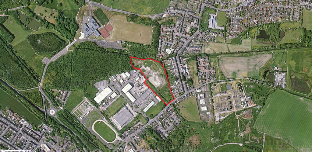
Before:

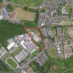
After:

Further Work
Enzygo are now involved with providing planning advice to Hartwood Estates regarding the proposed development of the Site and continue to undertake hydraulic modelling for flood map challenges within the property and development sector.
PDF Article
Flood Modelling at Low Valley, Darfield
Click here to view PDF.